










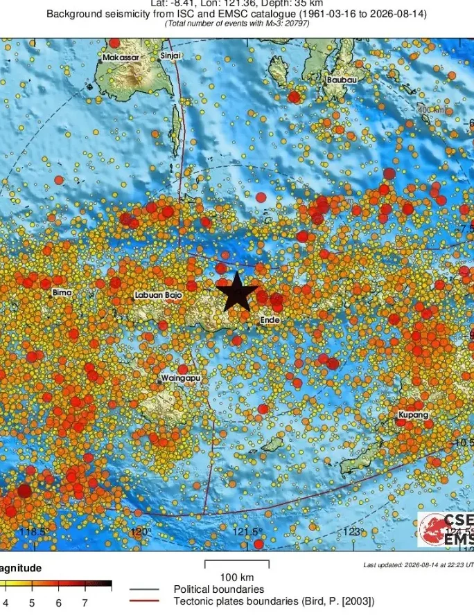
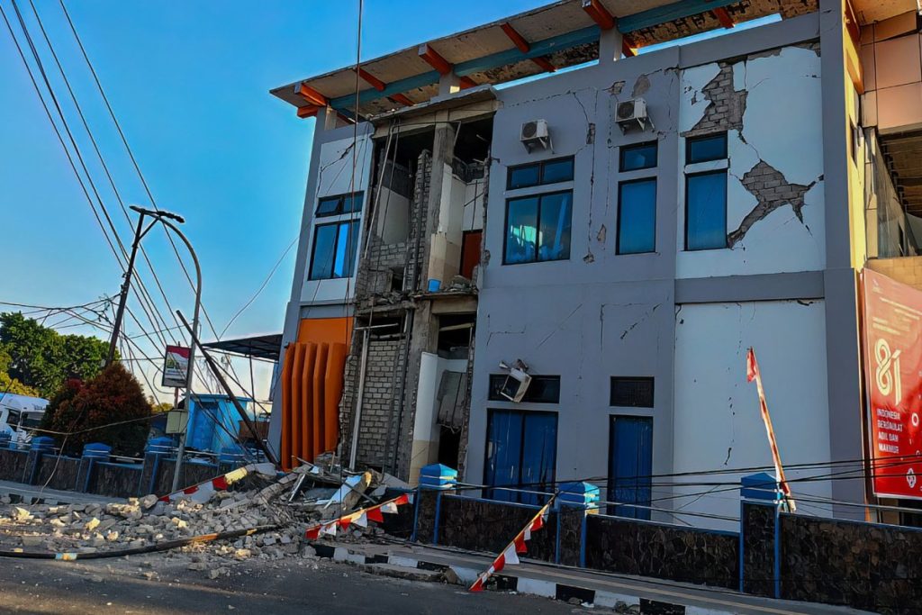
The sea floor off Indonesia’s Flores region buckled with terrifying force early on Saturday morning, August 15, 2026, sending a 7.7-magnitude earthquake rippling through one of the world’s most seismically active corridors. The quake struck at 5:58am local time, with its epicentre sitting approximately 68 kilometres north-northwest of Ende, a city in East Nusa Tenggara province. The US Geological Survey recorded the event at a shallow depth of just 10 kilometres, a detail that matters enormously when calculating potential surface damage and sea disruption. A tsunami warning was issued shortly after. As of early reports, no immediate casualties or structural damage had been confirmed, though the situation remained fluid.
The Quake in Numbers
Numbers, in moments like these, carry their own kind of weight. A magnitude of 7.7 places this event firmly in the “major” category on the seismic scale, a threshold that geophysicists associate with severe shaking, structural damage, and the real potential to displace ocean water enough to generate dangerous waves. The 10-kilometre depth is particularly significant. Shallow earthquakes, generally those occurring at depths of 70 kilometres or less, tend to cause far more surface disruption than deeper ones because the energy has less earth to absorb before it hits the ground or seafloor above.
The epicentre’s position, roughly 68 kilometres offshore from Ende, offered some buffer for the immediate coastal population. But that distance shrinks fast when tsunami dynamics are in play. Waves generated by undersea quakes can travel at the speed of a commercial jet across open water, making even a 60-kilometre gap a matter of minutes, not hours, of warning time. According to initial reporting on the event, authorities moved quickly to assess the risk and communicate warnings to coastal communities.
Why Flores Keeps Shaking
If you have followed Indonesian seismic news with any regularity, Flores will not be a new name. The island and its surrounding waters sit at the intersection of several major tectonic plates, specifically within the complex zone where the Australian Plate, the Eurasian Plate, and the Sunda microplate interact. Indonesia as a whole is part of the Pacific Ring of Fire, that vast horseshoe-shaped belt of geological instability that accounts for roughly 90 percent of the world’s earthquakes and a significant share of its volcanic activity.
The Flores region has a documented history of major seismic events. In December 1992, a 7.8-magnitude earthquake struck the same general area, generating a tsunami that killed more than 2,000 people. That disaster left a deep imprint on how Indonesia thinks about coastal preparedness and early warning systems. Decades of investment in detection infrastructure followed, though the effectiveness of those systems has always depended on how quickly warnings reach ordinary people in remote coastal villages.
East Nusa Tenggara: A Province on the Fault Line
East Nusa Tenggara province is one of Indonesia’s easternmost administrative regions, a chain of islands stretching toward Timor-Leste. Ende, the city closest to Saturday’s epicentre, sits on Flores island’s southern coast and is home to roughly 130,000 people. The city is known culturally for its proximity to the Kelimutu volcano, which draws visitors from around the world for its tri-coloured crater lakes. But geologically, the setting means the city and its surrounding communities live with the constant low hum of seismic possibility.
Communities in this part of Indonesia tend to have generations of institutional memory about earthquakes and tsunamis. That knowledge, passed down through families and reinforced through periodic disaster drills, can make a meaningful difference in how quickly people move to higher ground when warnings sound. Still, the pre-dawn timing of Saturday’s quake, 5:58am, means most residents were likely asleep, sharpening the challenge of rapid evacuation.
Tsunami Warnings: The Race Against the Clock
The moment a significant undersea earthquake occurs near a coastline, the clock starts ticking in a very particular way. Indonesia operates the InaTEWS system, short for the Indonesia Tsunami Early Warning System, which was built substantially after the catastrophic 2004 Indian Ocean tsunami that killed over 200,000 people across more than a dozen countries, including a devastating toll in the Indonesian province of Aceh. The system integrates data from seismographs, GPS sensors, and deep-ocean buoys to generate warnings within minutes of a qualifying event.
Whether those warnings translate into saved lives depends on the last mile of the communication chain: sirens, mobile alerts, local officials with megaphones, and community networks. In dense urban areas, that chain is relatively robust. In the scattered coastal villages of Flores, it can be considerably more fragile. The absence of immediate casualty reports following Saturday’s quake is, cautiously, a positive sign, but emergency managers typically take hours to gather reliable information from remote areas.
Indonesia’s Long Record of Seismic Resilience
Indonesia is, by necessity, a country that has learned to live alongside geological violence. With more than 17,000 islands straddling active fault lines and hosting over 130 active volcanoes, the nation has experienced some of the most destructive natural disasters in recorded history. The 2004 Aceh tsunami, the 2006 Yogyakarta earthquake, the 2018 Lombok and Palu disasters, each event has reshaped not just landscapes but also policies, building codes, and community preparedness culture.
This accumulated experience is both a burden and a kind of hard-won expertise. Indonesian disaster management agencies have grown more sophisticated with each successive event, and international partnerships with bodies like the United Nations Office for Disaster Risk Reduction have helped translate lessons learned into practical protocols. Saturday’s earthquake is, in the immediate term, a story of swift warning issuance and, fingers crossed, minimal harm. But it is also another data point in the long-running story of a nation learning, quake by quake, how to bend without breaking.
What Happens Next
In the hours and days following a major offshore earthquake, several parallel processes unfold. Seismologists monitor for aftershocks, which can sometimes be nearly as strong as the original event and which often continue for days or weeks. Coastal authorities reassess tsunami risk as more data comes in from ocean buoys and tide gauges. Search and rescue teams move into potentially affected areas to check on communities that are difficult to reach by road. And government officials begin the preliminary work of damage assessment, which can take considerably longer in island regions where access depends on boats and weather.
The international scientific community will also be watching. A 7.7-magnitude event generates enormous amounts of seismic data that researchers use to refine models of plate movement, fault behaviour, and tsunami generation. Each major earthquake, as grim as that sounds, teaches geophysicists something new about the mechanics of the Earth beneath our feet.
For now, the people of Ende and the broader Flores coast are taking stock of a morning that began with the kind of violent awakening no alarm clock can match. The full picture of Saturday’s event will sharpen over the coming hours. But the broader picture, of a region sitting atop one of the planet’s most active geological systems, has been clear for a very long time.
As Indonesia continues to develop and expand coastal infrastructure in provinces like East Nusa Tenggara, the question that demands an honest answer is this: are the country’s early warning systems, building standards, and community preparedness programmes genuinely keeping pace with the scale of the seismic risk, or is the gap quietly growing wider with every new coastal development?